


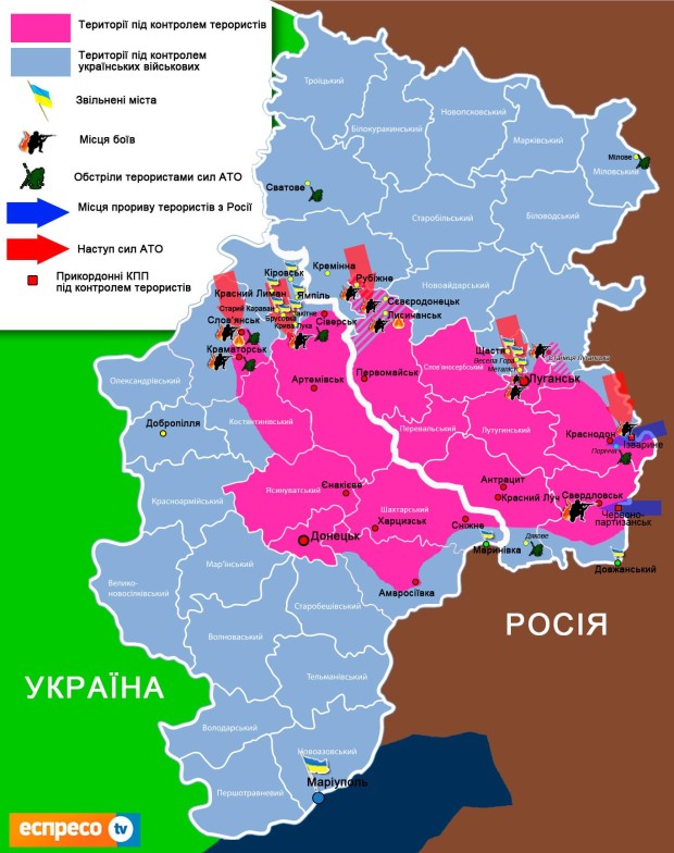
Sunday I spent a little time to look grosso modo at the military geography of the conflict. The situation has changed quickly in the central Donetzk Oblast and the maps are seemingly the work of amateurs and there is the ever present fog of war so those should only be taken as a rough guide. The conflict seems to be also heavily focused around cities and roads so the countryside is mostly left alone.
This maps shows the various regional entities of the two contested Oblasts and was thus useful to estimated very roughly the number of people living in ares not under direct Ukrainian control.
This shows broadly the recent advances on a topograhic map. In the North the frontline runs roughly along the Siversky Donets. It marks for a considerable distance the state border.
I have looked at some others and there are sometimes considerable differences. However they are rather useful to get those rough numbers.
Perhaps the biggest take-away is that the Ukrainian state is currently not controlling areas in which live between 5-5.5 million citiziens. A bit less then half of that is living in occupied Crimea with its less then 2.4 million people. The other area covers parts of the Donetzk and Luhansk Oblasts with a population of somewhere between 2.6 and 3 million. Depending on the number of refugees those numbers could be lower by some margin.
Overall the speratists are 'controlling' the cities of an area holding around 1/15 of the pre-war Ukrainian population. Puts a good deal of the media reporting into perspective.
@kaur: Indeed, as usually small crowds and perhaps to a good degree paid, something regularly done under the fugitive ex-president. So far all points to rather weak popular support for the seperatists cause which of course doesn't mean that the others love the current Ukrainian government.


Bookmarks